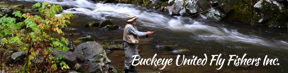

"Local Waters" Presentation
by Bill Schroeder
September 2020
�LITTLE MAIMI CONSERVANCY - 50 YEARS 0F CONSERVATION AND STEWARDSHIP�
“WILD RIVER ECOLOGY”---
VIDEO LINK
(Please allow 10 seconds to load and start this 10 minute video)
BUFF Becomes First Adopt-A-Stream Steward
On Five Miles of the Little Miami Wild and Scenic River
Led by Conservation Coordinator Donn Rubingh and BUFF members Steve Lilly, Lou Haynes,
George Sutthoff, and Little Miami River Coordinator, Bill Schroeder, Buff has adopted the 5 mile
stretch of the Little Miami River from the Carl Rahe Memorial Access below the Old 3C Bridge
at Fosters, to the Issac Walton Facility below Loveland. This means we will be organizing three
events a year in which buff members and others will be invited to participate in events designed
to keep that section clean and free of trash and debris.
The adopt-a-stream program was started
by Rivers Unlimited and is managed by Aaron Roark, a
founder and board member of the Friends
of the Little Miami, a non-profit organization dedicated to stewardship in the river valley. Aaron's efforts were approved and endorsed by ODNR Scenic Rivers
Division and BUFF became the first group to choose and �adopt� a section of the Little Miami.
The Fosters-Loveland section was chosen because of its easy accessibility, and the hope that BUFF
members would like to learn more about the fly fishing opportunities on the river, at the same time
helping to provide the stewardship that helps keep it a clean and healthy river. Special signs will be
placed at the Carl Rahe Memorial Access and at the Issac Walton Access to identify Buff as a steward
of that section of the LMR.
More information will be provided about dates and times of the three events
that will begin next spring and sign-up sheets will be provided. We are honored and proud to among the leaders of this important effort. The success of this venture will depend of the active participation of the BUFF membership. Your help is needed.
Please sign-up or email Donn Rubingh at drubingh@fuse.net to participate.
The Little Miami Wild and Scenic River
Bill Schroeder, BUFF Little Miami River Coordinator
Wild and Scenic River
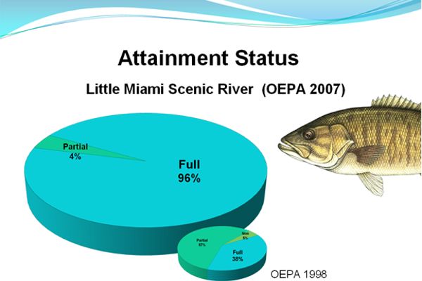
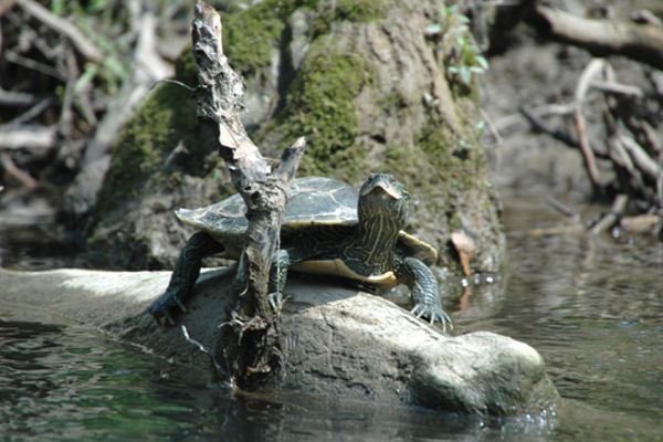
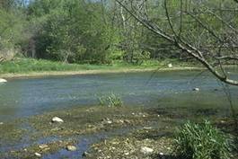
The Little Miami River is a national and state designated Wild and Scenic River. It meanders more than 105 miles from its headwaters above the Clifton Gorge to its confluence with the Ohio River at Cincinnati. The first river in Ohio to receive the designation of a Wild and Scenic River, it was also among the earliest to receive that designation under the national program. It is a great river for fishing, paddling and enjoying beautiful scenery. The Wild and Scenic River designation means it has met all the requirements, standards, qualifications and tests required for such designations, and enjoys the benefit of laws and regulations for protection and preservation that are reserved for rivers and streams of such outstanding quality and value. It supports an enormous diversity of fish and wildlife species. Of 160 different species of fish found in the waters of Ohio, over 80 have been found in the Little Miami River and its tributaries, such as Caesar Creek (Oregonia), Todd’s Fork (Morrow) and the East Fork (Batavia to Milford). In 2007, the Ohio DNR reported that the LMR had achieved full attainment of Ohio EPA water quality standards for warm water streams in our state.
What does this mean to us?
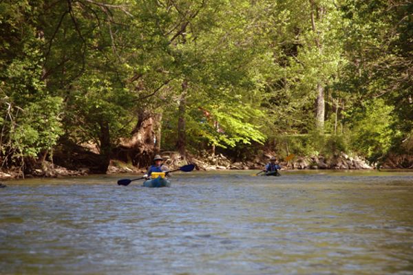
To me, this means that there is 105 miles of terrific, healthy, beautiful and productive fly fishing, all within a two-hour drive from my house. One of my favorites is only two miles from home, where I often wade fish beneath the Fosters Bridge, or kayak/fish the 4 ½ miles from Foster’s to Loveland, which can easily be paddled in an under two hours or paddle-fished in three. To you, it means there is a top quality nearby fly fishing destination easily reached and fished on a day-trip.
Favorite Fish Species- Smallmouth to Mussels.
The LMR is a warm water habitat stream. That means it does not maintain consistent cold water temperatures that support cold water species such as trout. While there are 80 species of fish found in the LMR, not all of them are favorite targets of fly fishermen. However, several of the most plentiful species of fish in the Little Miami are also favorites of fly fishermen. My personal favorite is the smallmouth bass. But I also enjoy largemouth, sauger, walleye, white bass, rock bass and others that are also present. One of the most fun aspects of fishing the LMR is you never know what you may find on the end of a fly line. I once caught a 24” gar that was not even hooked. It just clamped firmly on a large streamer I was casting, and refused to let go, until I pried open its jaws. Several times I have caught mussels that clamped their shells onto a weighted streamer I fish bouncing along the gravel bottom of the LMR.
<
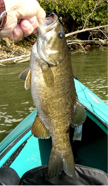
Not until I began focusing on the LMR did I experience first-hand that there truly is a local game fish rivaling the excitement and challenge of trout. Like rainbows, smallmouth are voracious eaters that require a constant supply of food and nourishment to thrive in swift moving water. Also like trout, they love the highly oxygenated water below frothy riffles and runs. However, unlike trout, smallmouth seldom make timid strikes, turn away, or merely follow and watch, once attracted to a likely offering. More often they strike viciously, “hammering” their targeted prey, and are often hooked deep in the mouth. Like trout, they often run and jump trying to dislodge the hook. Like trout, they like seem to love the highly oxygenated water of fast moving runs and riffles. Unlike trout, they seldom target a particular nymph or fly to the exclusion of others food. More often they will cruise an area in search of anything that presents itself and attack any number of different prey. A hungry smallmouth will strike patterns mimicking sculpin, hellgrammites, crawfish, frogs or any number of insects, with unbiased vigor. Their feeding habits are more “search and destroy” than lay back and wait for the perfect presentation of a specific hatching insect to arrive.
Other popular species I have caught on flies in the LMR include crappie, carp, channel catfish, and non-indigenous stocked fish like the hybrid saugeye (cross between a sauger and walleye), and striped bass that seasonally follow bait fish up the LMR from the main stem of the Ohio River and commonly reach 10-15 pounds in size. Muskies are also present, but rare and difficult to catch. They are stocked into lakes like Cowan Lake and Caesar Creek, and occasionally get into the LMR through or over the dams.
When to Fish.
Like trout streams, everything depends on the condition of the water. It is a waste of time to fly fish t he LMR when it is high and muddy, or when the water temperature is too cold. My favorite times of the year are spring and fall if the water level is right and there is decent clarity. However, I have had very nice fishing days throughout the summer, and well into November. I have even caught smallmouth bass in the LMR on a warm late-fall afternoon, when there is ice along the edges. Generally, I prefer the river level to be low (but still flowing and moving) because I can usually depend on the fish being concentrated in feeding troughs or runs below or in the riffles and fast moving water. In the dog days of summer, I have caught nice smallmouth casting streamers directly into the frothing whitewater. I am mystified how they manage to hang out and feed in water that fast, but they do! Trout do it, so why not smallmouth. For me, the best time of day is evening, one hour before dark to one hour after dark. I have also caught fish in the mid morning, noon and early afternoon. But evening is best. In late June and July, I like 8:00 pm to dark, and I never quit early. I have good fishing friends who are very successful fly fishermen, but always quit around 8:30 pm. I would rather start fishing then, and quit when I cannot see to cast, tie a knot or find my car than walk away from the best fishing of the day.
Favorite Places.
I am not an expert on the LMR. I can offer a few general observations and share some of my limited experiences fishing certain portions of it. I have fished areas of the river near Waynesville, Oregonia, Morrow, South Lebanon, Fosters, Loveland, Branch Hill, Milford, and Cincinnati. I have paddled the upper areas from Yellow Springs down (paddled the entire river in 2009). From what I have seen and heard, the best fishing could be in those upper reaches. But I have never fished any of that. Can you believe that?
How to get started.
First, before you grab your flyrod and head out, learn more about the LMR, and plan your trip carefully. Pick a place with easy access to some runs, riffles and holes with moving water. Try and partner up with someone who knows the river. Don’t expect to catch a dozen fish in two hours. It is more challenging than that, and it does take some time to figure it out and get into the groove. I recommend at first using some weighted streamers that bounce along the bottom and dart around like sculpins or small crawfish. For more information, here are some further resources.
Learn More About Fishing the LMR at the following web links:
Little Miami Inc: A local non-profit support organization that has been instrumental in support and clean-up efforts in the Little Miami River for more than 40 years. LMI deserves much of the credit for protection and improvement on the main stem of the LMR. www.littlemiami.com/.
Little Miami State Park: http://www.dnr.state.oh.us/parks/lilmiami/tabid/756/Default.aspx This web site is a part of the Ohio State Parks web information system and is maintained because more than 45 miles of the Little Miami River Scenic Mulitpurpose Trail are a part of an Ohio State Park called the Little Miami State Park. A map of this park can be found on their web page at http://www.dnr.state.oh.us/Portals/2/parkmaps/littlemiamiparkmap.pdf.
Sculpin Patterns: http://globalflyfisher.com/streamers/fish/muddler/sculpinthumbs.htm.
The Little Miami State and National Scenic River (Ohio) -- Main Branch
Web Site of Thomas P. Martin, Ph.D., FACSM, Wttenberg University :
http://www4.wittenberg.edu/academics/hfs/tmartin/LittleMiami/LittleMiamiRiver.htm.
This is the best source of mile points GPS locations and access information I have found anywhere.
Little Miami State and National Scenic River
 On April 23, 1969, the Little Miami River earned the distinction of becoming Ohio's first designated State Scenic River.
From its headwaters in Clark County, the Little Miami flows southwesterly for more than 100 miles, traversing five counties before arriving at its confluence with the Ohio River. The Little Miami River was the first Ohio stream to also be designated as a National Scenic River.
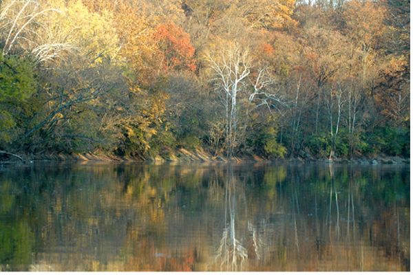
Noted for breathtaking vistas and scenery, the Little Miami River supports rich and abundant aquatic life.
More than 87 species of fish, 36 species of mussels (including five state endangered species) and numerous species of breeding birds reside within the river valley.
Public access to the river is readily available through facilities such as Clifton Gorge State Nature Preserve, John Bryan State Park, and county park district site along the river.
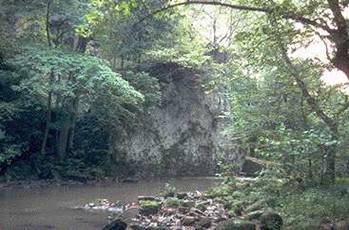
 The Little Miami flows through several natural areas which highlight the wide diversity of Ohio's ecology. For instance, at Clifton Gorge State Nature Preserve, the high dolomite cliffs of the narrow gorge provide an exceptional display of plants most common in climates much farther north.
Boreal relicts such as Hemlocks and Junipers provide an interesting view into Ohio's glacial past. Additionally, more than 340 species of wildflowers are found in the preserve. Their flowers can best be observed during the spring and summer.
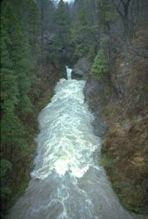
The Little Miami is an excellent example of a scenic river. In its northern reaches above Clifton Gorge, the river is a small meandering stream. Near Clifton, the river changes character suddenly where it cuts through dolomite bedrock, creating sheer walls of breathtaking beauty.
Moving south, the river grows in size and the valley widens again until reaching Caesar Creek where bluffs as high as 300 feet line the river. Nearing Hamilton and Clermont counties, the flood plain widens to two or three miles in places.
The Little Miami Scenic River Valley is rich with relics of Ohio's past. Countless Indian villages flourished along its banks. Fort Ancient, a world famous mound builders site, is located on high bluffs overlooking the river. Tecumseh, the renowned Shawnee Chief, was born in the valley, and Daniel Boone spent time along the river, both exploring and as a prisoner of the Shawnee.
 The Little Miami watershed is home to a wide variety of flora and fauna. This area is one of the fastest growing parts of Ohio and development is rapidly changing the landscape from agricultural to residential/urban.
As development continues to grow it will become increasingly important to ensure that riparian corridors along the Little Miami and its tributaries are protected, for it is the forested river banks that remain the lifeline and basic ingredient necessary to protect this valuable state water resource. The value of the river and the rich living resources of the valley are counting on us for their protection.
LMR ACCESS POINTS and Fishing/Paddling Information
Below are the access points with river miles and GPS locations that I have visited and/or passed on the river. Some of the facilities detail changes periodically and should be verified or updates as part of your trip planning process. The blue FISHING/PADDLING NOTES are my own and represent 2009 data.
83.1 Jacoby Road Launch, Morris Bean Reserve, Greene County Park District on river left. SR-72 to Clifton, 4 miles SW on Clifton Road, 0.5 mile NW on Jacoby Road to access. Also, US-68 to Clifton Road (4 miles south of Yellow Springs), 2 miles NE on Clifton Road,0.5 mile NW on Jacoby Road to access.
GPS – N 39o 45.834 W 83o 54.12
Parking Lot -
Restrooms -
Camping - permission required( fee) -
Picnicking
FISHING/PADDLING NOTE: This is a beautiful spot on the river where the water is clear and good fishing is available.
60.1 RiversEdge Canoe Livery, access river right with permission, 4 miles N of Waynesville on US-42
GPS – N 39o 34.505 W 84o 01.937
Parking Lot -
Canoe Rentals -
Restrooms -
Picnicking -
Water -
Food - Snacks
RiversEdge Canoe Livery, 3928 St. Rt. 42 S., Waynesville, OH 45068, 1-800-628-2319 or (937) 862-4540
FISHING/PADDLING NOTE: This is an excellent choice for canoe/kayak rental and paddle trips upstream of Waynesville ending at River’s Edge. They are also very knowledgeable about river conditions from Waynesville up river. If you plan to start here and float down, be advised that the Corwin Dam is just 4.8 miles downstream and requires a portage (see below).
55.3 CORWIN DAM (4-foot), portage river left. Access from New Burlington Road 1 mile N of Harveysburg Hill Road bridge in Corwin
GPS – N 39o 31.900 W 84o 03.845
Pulloff
The short portage is not obvious and has brush, trees, and rocks to negotiate.
FISHING/PADDLING NOTE: Just below Corwin Dam there are deep holes and runs where turbulent water provides some excellent smallmouth fishing. A wade fisherman can pull off the road and park, then walk down a path to the dam and the area below.
54.4 CLINT FULTZ MEMORIAL PARK (WARREN COUNTY PARK DISTRICT - ODNR FUNDED CANOE-KAYAK LAUNCH) Harveysburg Hill Road Bridge in Corwin, access river left just before bridge. Facilities 0.25 mile E in Corwin along Little Miami Scenic Trail. US-42 to Waynesville, 0.5 mile E on Harveysburg Hill Road. Web information at: http://www.co.warren.oh.us/parks/parks_list/clint_fultz.htm.
GPS – N 39o 31.632 W 84o 04.802
Parking Lot -
Restrooms -
Picnicking -
Water -
Food
JUST ACROSSTHE RIVER ON THE WAYNESVILLE SIDE IS ALSO Bowman Park Warren County, 0.25 mile W, picnicking and restrooms. See web info at:
http://www.co.warren.oh.us/parks/parks_list/bowman.htm
51.2 Caesar Creek Access, Little Miami State Park, KAYAK AND CANOE LAUNCH with public access river left just before Middletown Road covered bridge.
GPS – N 39o 29.890 W 84o 06.031
Parking Lot
WARREN COUNTY HISEY PARK AND CAESAR CREEK GORGE. See web information at:
http://www.co.warren.oh.us/parks/parks/hisey.htm
50.9 Caesar Creek enters Little Miami: FISHING/PADDLING NOTE: This is the confluence of Caesar Creek with the LMR. It provides beautiful clear water, many riffles and runs and excellent fishing in this final 2 ½ mile section of Caesar Creek running from the lower side of Caesar Creek Dam to the LMR. There are parking facilities on both ends of this stretch. The Corps of Engineers maintains a parking lot, restrooms and shelters in a park just below the Caesar Creek Dam, and Ohio DNR Maintains a public parking lot on the lower end in a trailhead nature preserve trail head at Corwin Rd. An excellent 4-5 hour wade fishing day trip is to start at the dam and fish all the way down to the trailhead park at the lower end.
47.7 Oregonia Road Bridge in Oregonia, emergency access only
GPS – N 39o 27.299 W 84o 05.888
45.9 Little Miami Canoe Rental Old Mill Base (formerly Gordon’s), access river left with permission. I-71 Exit 36 (Wilmington Road), 1 mile W to Mathers Mill, 0.1 mile N on Corwin Road.
GPS – N 39o 25.917 W 84o 06.144
Parking Lot -
Canoe Rentals -
Restrooms -
Camping(fee) -
Picnicking -
Water -
Food - Snacks
Little Miami Canoe Rental, 219 Mill Street (St. Rte 123), Morrow, OH 45152, 1-800-634-4277 or (513) 899-3616, http://www.littlemiamicanoe.com
45.7 Mathers Mill ODNR PUBLIC Access, Little Miami State Park, access river left at Wilmington Road Bridge. I-71 Exit 36 (Wilmington Road), 1mile W to Mathers Mill.
GPS – N 39o 25.765 W 84o 06.315
Parking Lot
FISHING/PADDLING NOTE: THIS IS A NICE PLACE TO PUT IN AND FLOAT or wade down river to nearby accesses at Morgan’s Ft. Ancient Canoe Livery just two miles down stream, or Morgan’s Campground (41.5) 4.2 miles down stream. There is a Warren County Park Nature Preserve at Mathers Mill.
For web information visit:
http://www.co.warren.oh.us/parks/parks/mathers.htm
44.7 I-71 Bridge
GPS – N 39o 25.185 W 84o 06.235
43.7 Fort Ancient Access , Little Miami State Park, access river left just past SR-350 bridge. I-71 Exit 32, SR-123 0.25 mile S to SR-350 E, 3 miles to bridge. Parking lot and canoe access. Morgan’s Fort Ancient Canoe Livery located adjacent to Access
GPS – N 39o 24.385 W 84o 06.017 FISHING/PADDLING NOTE: Although this is the main location of Morgan’s Outdoor Center and Canoe Livery, it is actually an ODNR Public Access where launching, parking, wading and fishing are free and open to the public.
Parking Lot -
Canoe Rentals -
Restrooms -
Picnicking -
Water -
Food
Morgan’s Ft. Ancient Canoe Livery, 5701 State Route-350, Oregonia, OH 45054, 1-800-932-2663 or (513) 932-7658, http://www.morganscanoe.com
41.5 Strout Road Bridge , Morgan’s Riverside Park, access river right just before bridge with permission
GPS – N 39o 22.753 W 84o 05.569
Parking Lot -
Canoe Rentals -
Restrooms -
Camping( fee) -
Picnicking -
Water-
Food
FISHING/PADDLING NOTE: This is a great place for camping, wading, launching etc. with full facilities and even small cabin rentals available from Morgan’s. Downstream takeout points are abundant for the next five miles down stream. See below.
39.0 WARREN COUNTY MORROW VETS PARK AND KAYAK/CANOE PUBLIC ACCESS. FISHING/PADDLING NOTE: This is a good takeout point with parking and portalets available. It is also a nice launch point for floats to Halls Creek, Fosters or Loveland. There are some great pools and runs along the stretch from Morrow to Fosters and on to Loveland. For web info visit: http://www.co.warren.oh.us/parks/parks_list/morrow.htm.
38.6 Little Miami Canoe Rental, at SR-123 bridge (Mill Street) in Morrow, access river left just past bridge with permission.
GPS – N 39o 21.383 W 84o 07.744
Parking Lot -
Canoe Rentals -
Restrooms -
Camping( fee) -
Picnicking -
Water -
Food - Snacks
FISHING/PADDLING NOTE: This is another place where there is good camping and wade fishing.
Little Miami Canoe Rental, 219 Mill Street (SR-123), Morrow, OH 45152, 1-800-634-4277 or (513) 899-3616, http://www.littlemiamicanoe.com
38.5 Morgan's Canoe Livery Access, with permission - river right
Todd Fork enters Little Miami - river left
37.0 Halls Creek Access, Little Miami State Park - river right. Entrance on Mason-Morrow-Millgrove Road (CR-38) just E of intersection with Halls Creek Road
GPS – N 39o 21.944 W 84o 09.330
Parking Lot
FISHING/PADDLING NOTE: This ODNR public access and canoe launch is currently closed but planned for reopening soon (maybe next year).
36.0 Stubbs Mill Road Bridge, emergency access only
GPS – N 39o 21.796 W 84o 10.434
33.4 Roger’s Ball Park at Hobart and High in South Lebanon, access river right just upstream of Main Street Bridge
GPS – N 39o 22.056 W 84o 12.932
Parking Lot -
Picnicking
32.9 SR-48 Bridge, emergency access only
GPS – N 39o 22.126 W 84o 13.492
32.1. Old Penn Central Railroad Bridge
30.7 Grandin Road Bridge at Kings Mills, emergency access only
GPS – N 39o 21.108 W 84o 14.554 FISHING/PADDLING NOTE: This is the old King’s Mills Peters Powder factory. The LMR trail passes through here and there is public parking , but no canoe/kayak access.
28.2 Old 3C Bridge in Foster - facilities river left
GPS – N 39o 19.315 W 84o 15.143
Parking Lot (Hamilton Township) -
Restrooms -
Picnicking (with permission) -
Water -
Food
Train Stop Restaurant river left just before bridge.
28.1 New 3C Bridge (SR-3 & US-22) in Foster
GPS – N 39o 19.215 W 84o 15.144
27.9 Carl A. Rahe Access (formerly Glenn Island Public Access), Little Miami State Park, access river right 0.2 mile past new 3C Bridge in Foster. Entrance on Old 3C highway under new 3C Bridge.
GPS – N 39o 19.096 W 84o 15.114
Parking Lot -
Restrooms -
Picnicking
FISHING/PADDLING NOTE: This is my favorite access point for both wade fishing and launching for a float to Loveland. Upstream of the launch are great runs and deep troughs for smallmouth, sauger and several other species.
23.9 Bishop City Park in Loveland, access river right just past West Loveland Ave. Bridge, restrooms/water/food across bridge.
GPS – N 39o 16.105 W 84o 15.662
Roadside Parking -
Restrooms -
Picnicking -
Water -
Food
23.7 Loveland Canoe Rental and Outdoor Center at Carl Brown and Crutchfield Place in Loveland, access river left, just past railroad bridge, with permission.
GPS – N 39o 15.987 W 84o 15.634
Parking Lot - Canoe Rentals - Restrooms - Camping(fee) - Picnicking - Water - Food
Loveland Canoe and Kayak, 200 Carl Brown Way, Loveland, OH 45140, (513) 683-4611 or 683-4604
FISHING/PADDLING NOTE: This is a great place with full facilities. From here, you can rent a canoe or kayak and they will transport you and your gear upstream to Fosters Carl Rahe access that is just under four miles. That can be paddles in under two hours, but there are several excellent fishing holes and runs that can make it a 4-5 hour fishing outing. Also Loveland will transport your boat and gear to Fosters for $10 per boat, solving your transportation need for this float if you have your own kayak or canoe.
21.5 Branch Hill-Guinea Road Bridge, emergency access only
GPS – N 39o 14.801 W 84o 17.691
20.9 I-275 Bridge
20.6 Lake Isabella Park, Hamilton County Park District, access river right 0.25 mile past I-275 Bridge. I-275 Exit 52, 0.5 mile S on Loveland Road, nominal fee required.
GPS – N 39o 14.150 W 84o 17.964
Parking Lot -
Restrooms -
Picnicking -
Water
18.1 SR-126 Bridge, Remington Rd, access river left
GPS – 39o 12.502 W 84o 19.116
17.7 Kelley Nature Preserve, Clermont County Park District, canoe launch just W of Miamiville off SR-126
GPS – N 39o 12.547 W 84o 18.385
Parking Lot -
Restrooms -
Picnicking
17.0 SR-126 Bridge (Miamiville Road) and bike path bridge
GPS – N 39o 12.647 W 84o 17.602
15.0 Access at end of Lincoln Road off SR-126 just E of Camp Dennison, DAV Ballfield just S of put-in
GPS – N 39o 11.679 W 84o 16.909
Roadside Parking
13.5 Access river left just N of American Legion Ballfield in Milford with permission
GPS – N 39o 10.685 W 84o 17.671
13.0 Canoe Launch at Jim Terrell Park, City of Milford, just S of US-50 and SR-28 Bridge in Milford, access river right. Also site of Little Miami River Excursions Company (formerly Bruce’s).
GPS – N 39o 10.224 W 84o 17.900
Parking Lot -
Picnicking
11.5 Confluence with East Fork of Little Miami River
10.9 Scenic River Canoe & Kayak at intersection of Roundbottom and Mt Carmel roads S of Milford, access river left with permission
GPS – N 39o 08.984 W 84o 18.795
Parking Lot -
Canoe Rentals -
Restrooms -
Picnicking
Scenic River Canoe & Kayak, 4595 Roundbottom Road, Cincinnati, OH 45244, (513) 831-5552
Check Clermont County map for directions
8.1 Bass Island Access, Hamilton County Park, southside of Newtown Road Bridge just S of intersection with US-50 about 2 miles E of Mariemont, access river left, nominal fee.
GPS – N 39o 08.226 W 84o 21.282
Parking Lot -
Restrooms -
Picnicking
6.9 Norfolk and Western Railroad Bridge
3.5 SR-125 (Beechmont Ave.) Bridge
GPS – N 39o 06.561 W 84o 24.092
Sign under bridge states 3.3 mile
1.5 Magrish Recreation Center Access at US-52 (Kellogg Ave.) Bridge just S of Cincinnati Municipal Airport (Lunken Field). Take Canoe Lane to parking lot, access river left.
GPS – N 39o 05.132 W 84o 25.262
Parking Lot -
Restrooms -
Picnicking -
Water
Sign under bridge states 0.9 mile. This is the last public take-out point on the river. Harbor Towne Yacht Club and Shelter Cove Marina (private) 0.25 mile S of Magrish Recreation Center, access river left with permission, River Mile 1.2
0.0 Mouth of Little Miami River where it empties into the Ohio River
GPS – N 39o 04.680 W 84o 25.910

Bill Schroeder is an attorney, long time BUFF member and fly fishing enthusiast,
member of the Warren County Park District Board of Directors, and devoted advocate of the
Little Miami State and National Wild and Scenic River