East Fork of the Little Miami River
Article and Photo credits: Jorge Villares, Jonathan Kennard
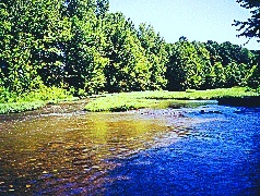
The East Fork of the Little Miami River in Clermont County is situated in an area experiencing significant pressure from development. Despite the pressure, the river is also meeting the state’s aquatic life use designation of an exceptional warm water habitat. This stream has been dammed forming East Fork Lake. The head waters above the lake are not of much interest to fly fishermen. Access is limited to a park in downtown Williamsburg.
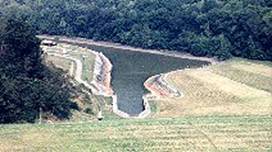
This a US Army Corps of Engineers artificial lake built in the 1970s. Its main purpose is to provide flood control for the lower Ohio River section. The lake offers a great opportunity to fish from a boat, but, since it is an artificial lake, there are few places where one can fish from the bank. There is limited fishing around the boat ramps and in the park areas at the dam, and in the East Fork State Park. The lake has been stocked with hybrid stripped bass as a way to control the large numbers of chubs and shiners in the lake. The lake also has a good population of smallmouth , crappie, catfish, carp, and drum. This is important since some of these fish will end up in the tail waters -- the East Fork River!!
Because this is a flood control lake, water levels in the river below the dam are dependent on the release of water from the lake. These releases do not necessarily coincide with the rainfall patterns in the area! Releases are dictated by the level of the Ohio River, and the need to prevent flooding throughout the region. Water levels can be checked by monitoring the gauge located just below the dam outflow.
The land around the lake is leased to the Ohio Department of Natural Resources (ODNR) for wildlife management. There are hunting and trapping areas, as well as an extensive camping area and swimming beaches for public use.
There are numerous access points on the East Fork River below East Fork Lake. Refer to the map and the write up below for detailed information.
This access is user friendly! Take Slade Rd east off of SR 222, and follow the
signs to the tail waters of the Dam. Park in the small lot on the left side--
half way down the long hill. To the left of the parking lot, there is an
abandoned road that you can walk down to the river. Fish either upstream or
downstream, however, be aware that land on the north side of the river may be
privately owned.
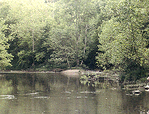
Upstream some sections are covered by trees making casting challenging; however, a path runs along the river all the way to the dam, making access easy. Watch out for the poison ivy!!! The river bottom is strewn with moss covered boulders making wading a bit dicey. Downstream may appear to be shallow, but, find the pocket water and you may be rewarded with a nice catch.
Additional parking and picnic areas are available at the end of the road at the dam outflow, and access to both sides of the river is available at this point. Fishing from a walkway is available, and many smallmouth feed here on crayfish that inhabit the riprap.
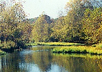
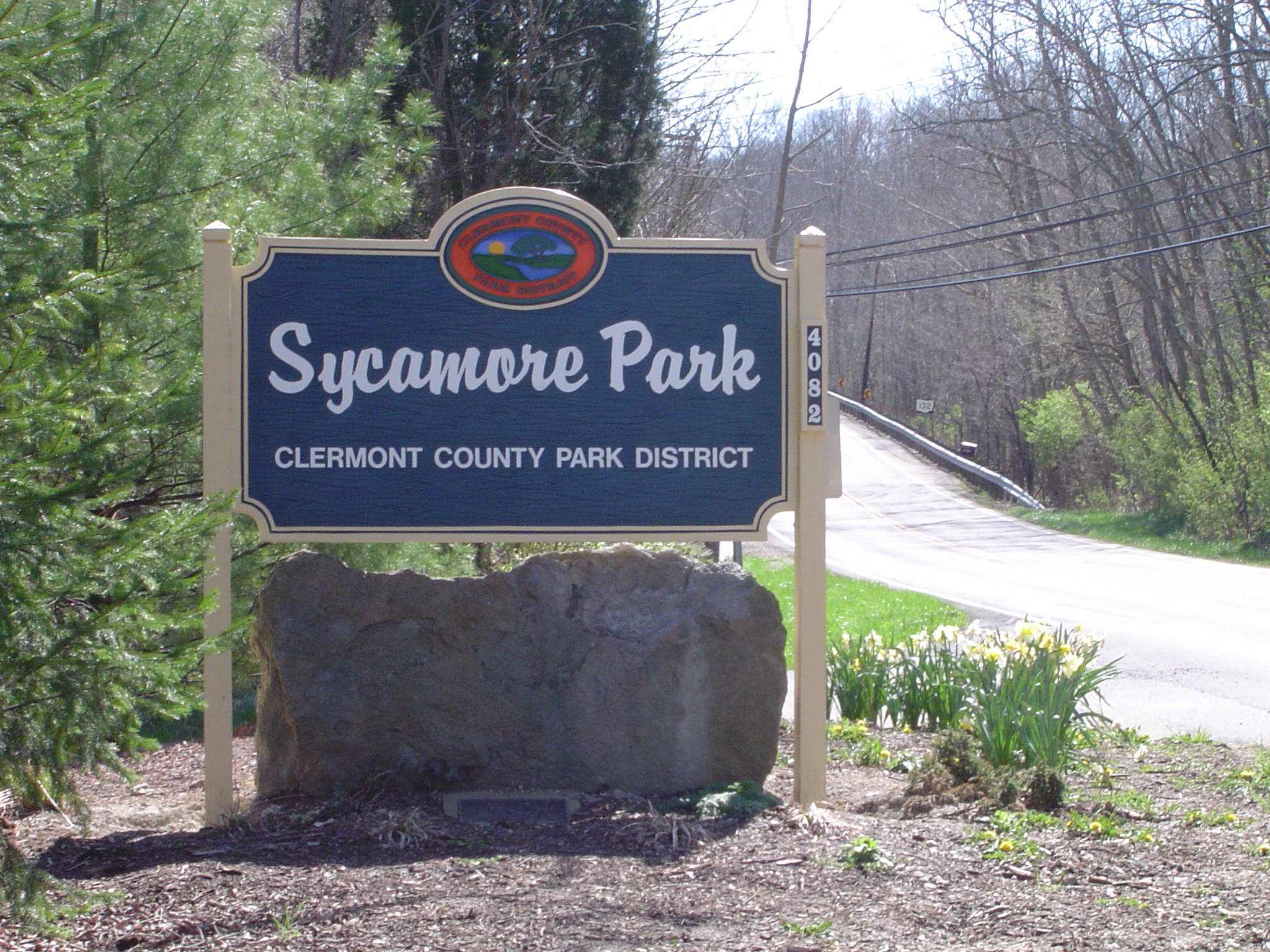
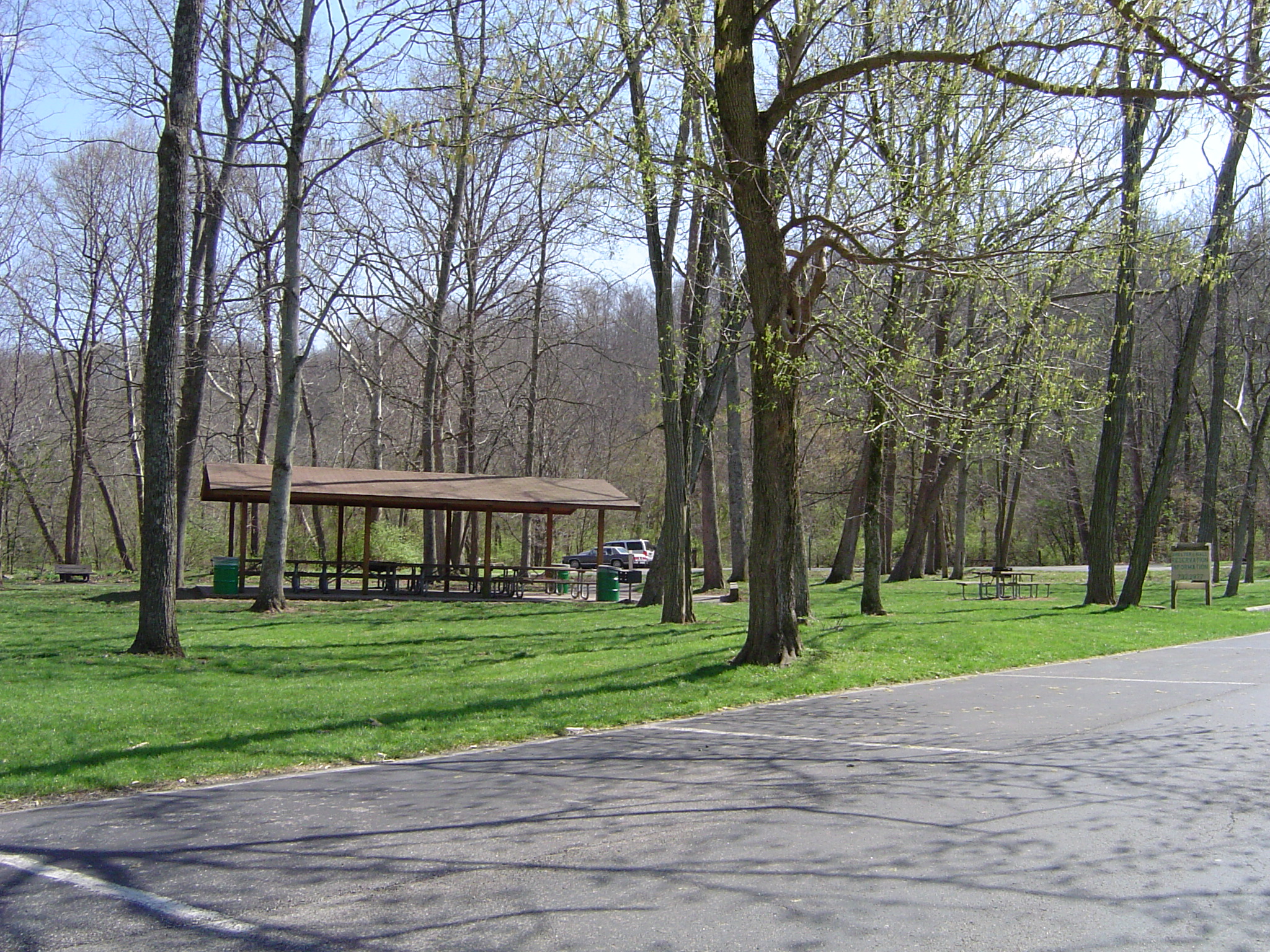
Sycamore Park (Clermont Co) Access
This access point is one of the best on the river. Located on SR 132,
approximately 1 ˝ mile south of Main Street in Batavia, this access is the
easiest--there is parking available all the way to the riverbank. The fishing is
good, but, sometimes you have to contend with overcrowding. This is a place for
the entire family. There are tables and shelters available for picnics on first
come, first served, and reservations basis.
At this point the river is a series of pools and riffles, ending in a long slow
water pool that extends downstream all the way to the low level dam at the
bridge in Batavia.
Batavia Village Dam Access
A low level dam is located south (up stream) from the Main St. bridge in
Batavia, and straight across from the Ohio Department of Motor Vehicles office
on SR 132. There is off-street parking, and, on Sunday and holidays, you can
park at the ODMV parking lot. This dam is extremely dangerous to boaters and
must be portaged. Bank fishing is available, but caution should be exercised.
This area is often utilized for bait fishing.

Located on SR 222, approximately 1 ˝ miles north of the Batavia Bridge, this access point is beside the Clermont County Park Maintenance building. There is one picnic table and a gravel road loop that extends to the river. Fishing consists of pools and riffles. This is a scenic point, HOWEVER, is located directly across the river from the Clermont County water treatment plant, and, if the wind is blowing in the wrong direction----- can be quite potent! BUFF conducts macro - invertebrate counts at this location. Dates are announced at the monthly meetings. Come join in, and get a better idea of what is in the river!
Limited access is available at the bridge on Olive Branch – Stonelick Rd. Land on both sides of the river is privately owned and most is posted. The river downstream of this point changes from a pool - riffle environment to slower moving, mud bottomed extended pools which are of little interest to fly fishers.